Punta
Guaniquilla
Nature Reserve
Cabo Rojo, Puerto Rico
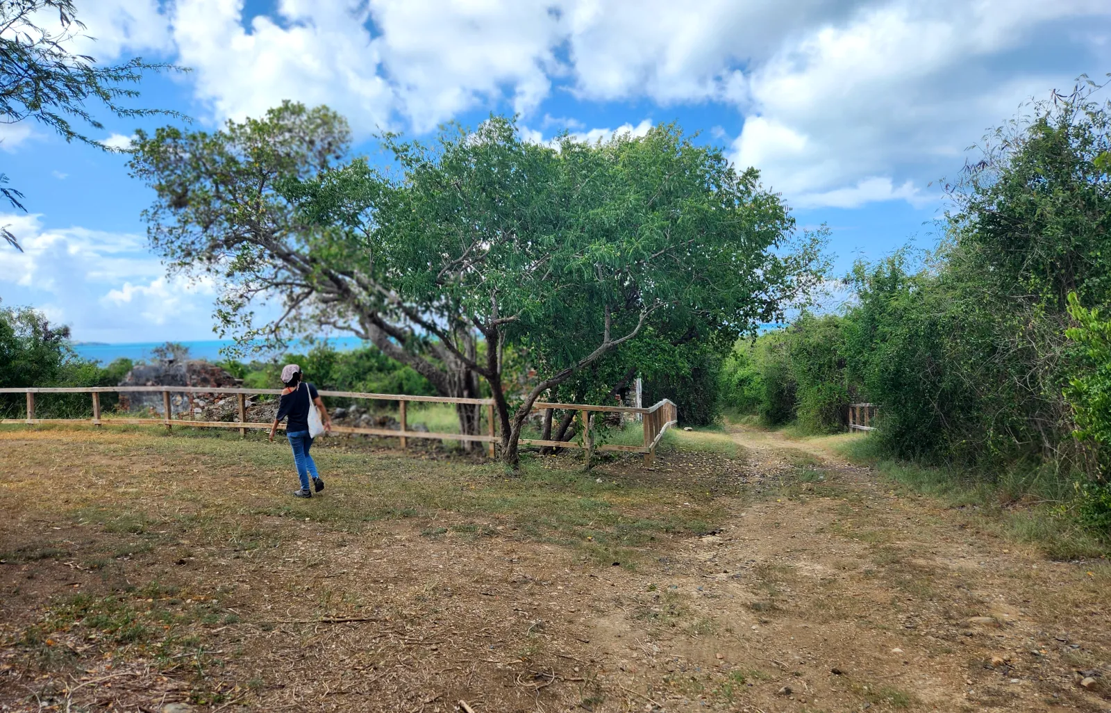
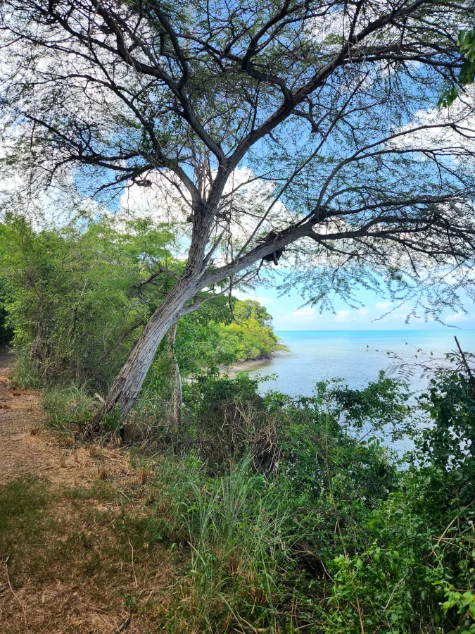
Punta Guaniquilla Nature Reserve is a unique treasure, where nature, history and biodiversity intertwine to create a refuge for nature lovers and adventurers.
This extraordinary place, located in the southwest of Puerto Rico, invites you to explore a mosaic of ecosystems that stand out for their beauty and ecological diversity.
Custodians: Para la Naturaleza
Route: aprox. 2 hours
easy - intermediate
Wear appropriate footwear, bring plenty of water, use sun protection, visit during the hours of least sun.
Limited, free parking on Camino Buyé street.
Opening hours:
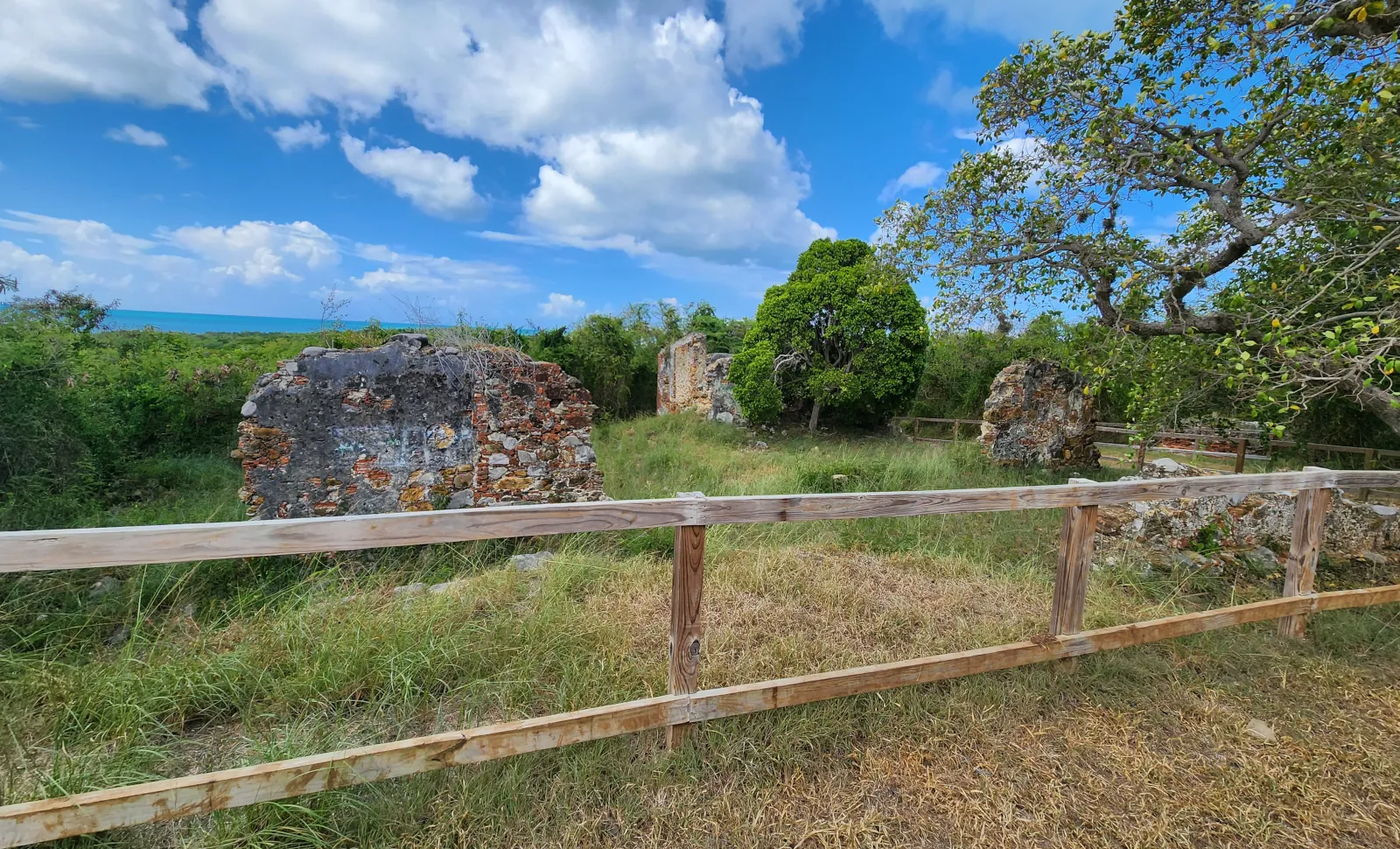
The historical and cultural wealth of the Punta Guaniquilla region is astonishing, from the stories of the Pirate Cofresí living in one of its caves to the ruins of Hacienda La Romana, dedicated to sugar production in the 19th century, and remains of the old railroad.
The reserve is a paradise for birdwatchers, with a record of 183 bird species, including migratory, resident, introduced, endemic and accidental species. It is a paradise for endemic species, with 15 of our 18 endemic species.
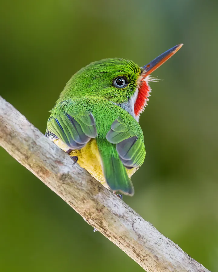
The San Pedrito is an endemic species that you will find around Punta Guaniquilla. San Pedritos are quite unique in their nesting behavior, as they are one of the few bird species known to build their nests on the ground such as on the sides of cliffs, hills, or riverbanks. This adaptation likely developed in response to the specific environmental conditions and nesting sites available in Puerto Rico.
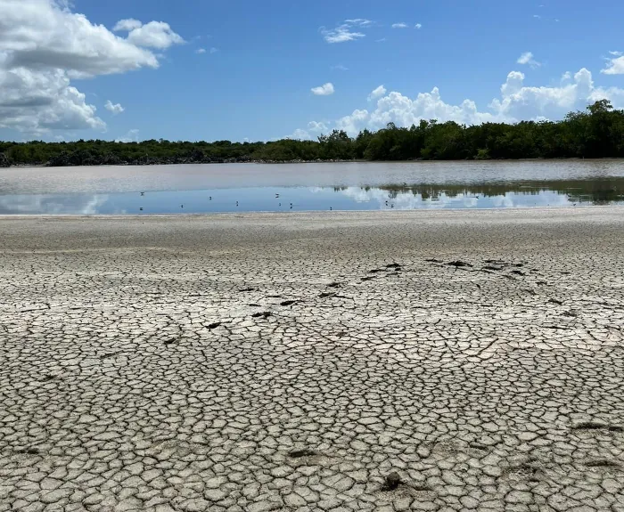
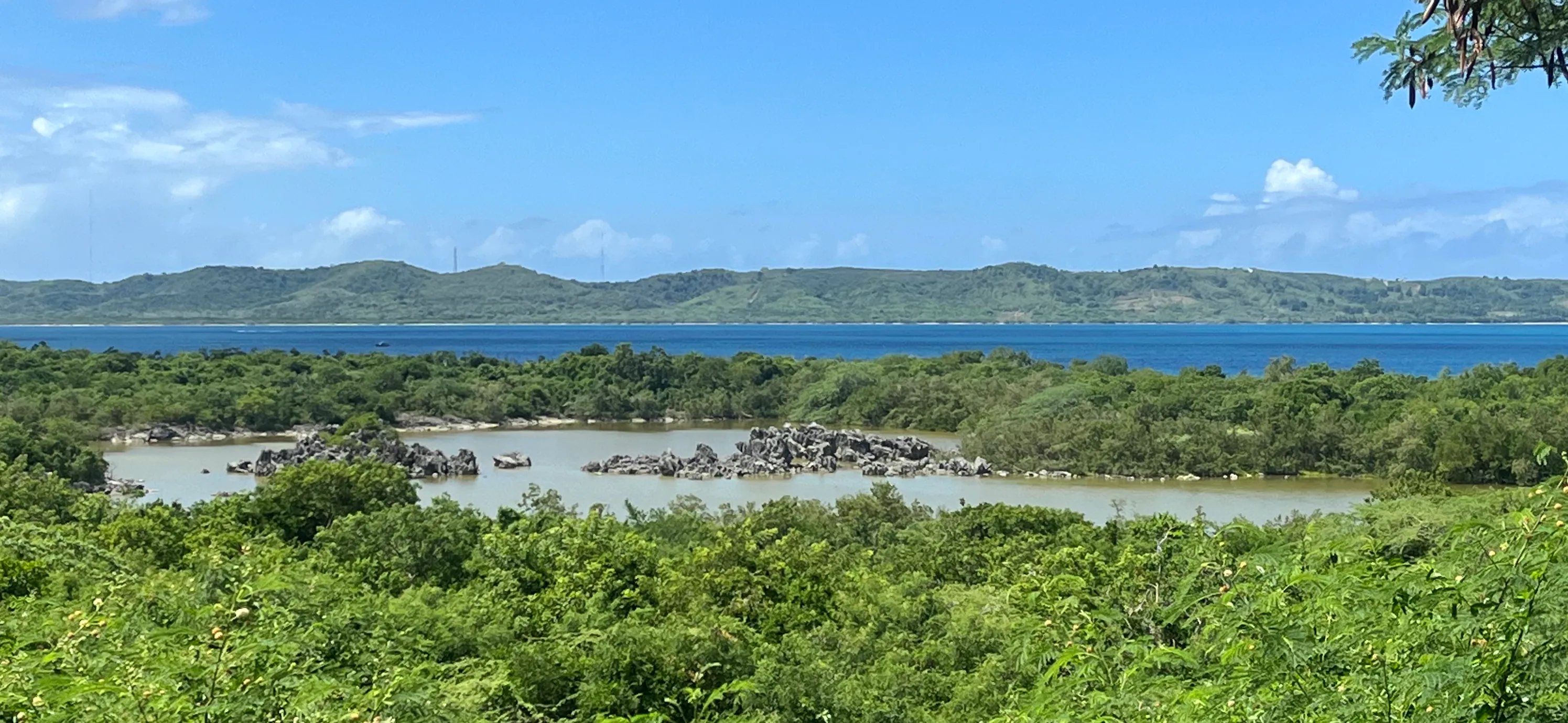
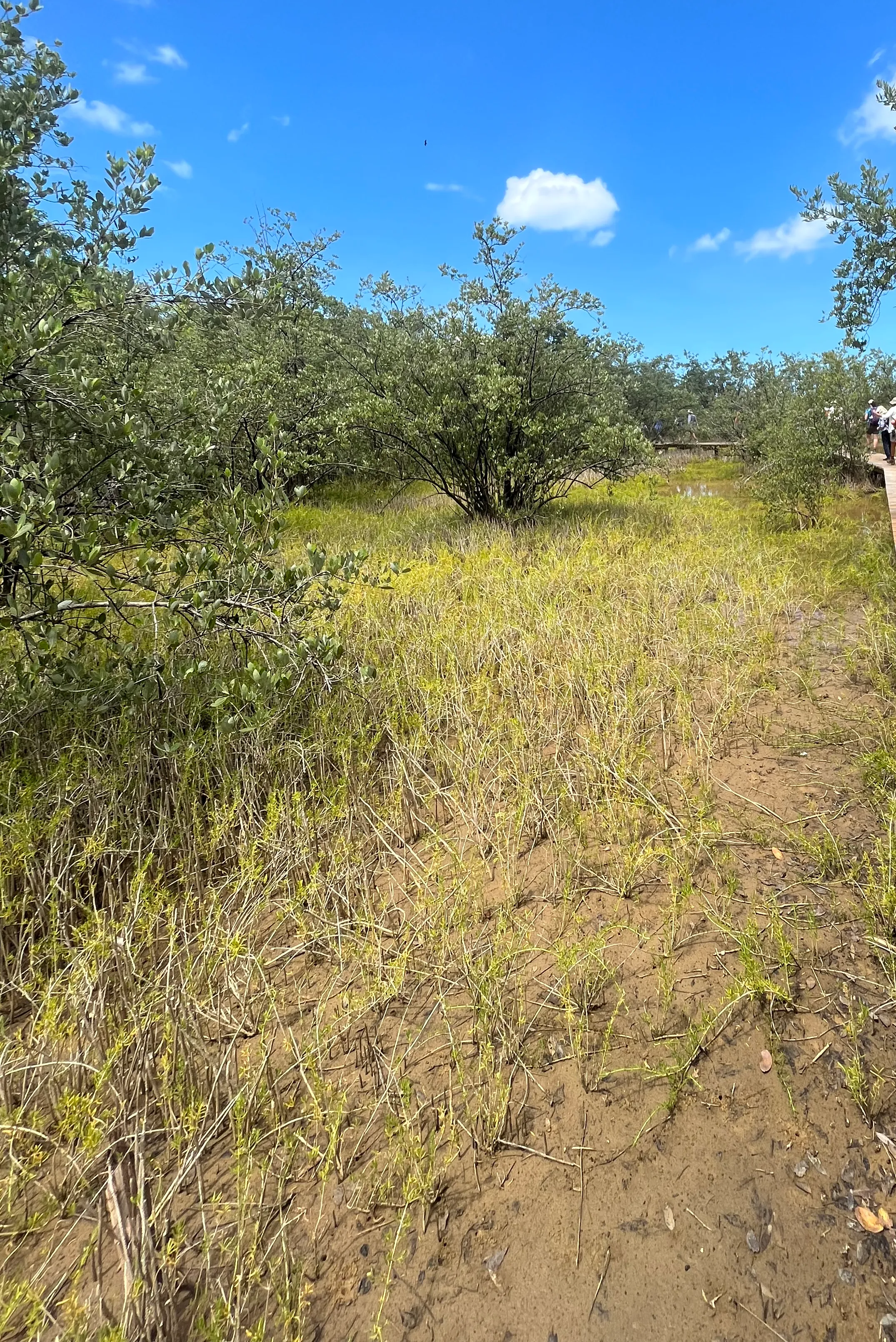
The lagoons are made of substantial clay soils that contract and expand in response to changes in moisture levels. The delicate balance between dry and wet periods is essential to the sustainability of this unique ecosystem.
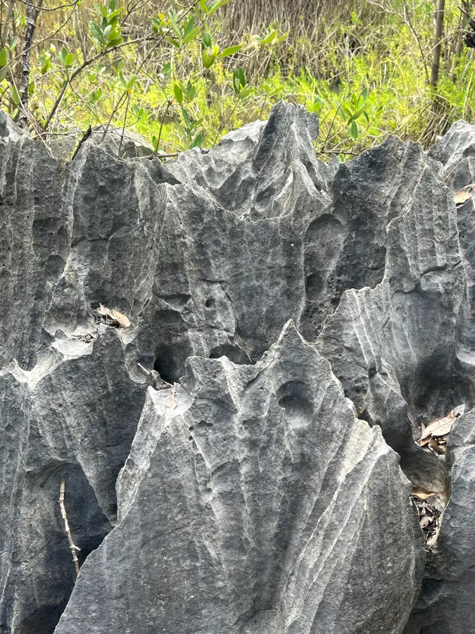
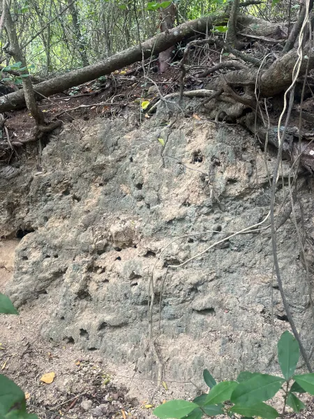
In the heart of Laguna Guaniquilla, there is a surreal landscape of rocks that are part of the southern karst belt and date back to geological processes that are more than 11,000,000 years old.
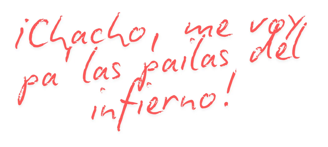
On the way to the Reserve along the Buyé road, you will also find brick and lime kilns, one of them called "Las pailas del infierno", where it comes from a famous popular phrase that refers to the distance between San Juan and Cabo Rojo.
Soils
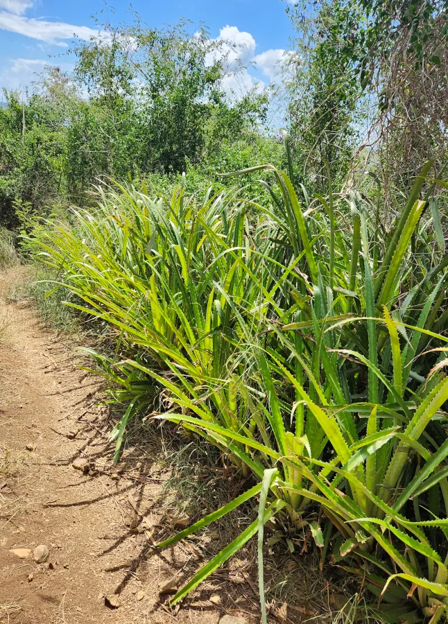
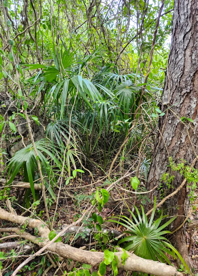
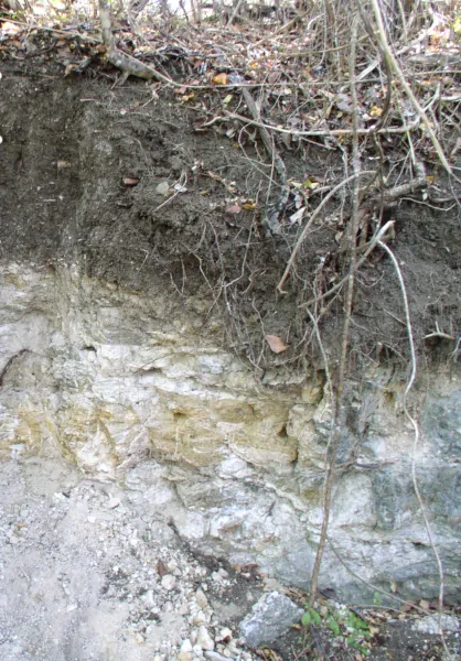
The Punta Guaniquilla Reserve is dominated by soils from the San Germán, Cerro Mariquita, Descalabrado, Bahía Salinas, Aguilita, and Fraternidad series. The great diversity of soils allows for unique landscapes that range from beach to subtropical dry forest. In shallow, limestone-rich soils, dry forest and its shrubs such as Trichilia triacantha, endemic to Puerto Rico, thrive, while in deeper, nutrient-rich soils of the Mollisol order, grasslands and prairies abound. You will notice variations in soil types as you explore the different types of vegetation. Many of these soils are categorized under the Aridisol or Mollisol orders, depending on the moisture regime. In this Reserve, you can observe over short distances the impact that the soil's moisture regime has on the vegetation.
Series: San Germán
Order: Mollisol
Taxonomic name: Clayey-skeletal, mixed, superactive, isohyperthermic Lithic Haplustolls
General description: The San Germán series consists of shallow, well-drained, and very slow-permeability soils. In the landscape, they can be found on the tops of slopes in highlands, mountains, and semi-arid valleys. These soils were formed in material eroded from a limestone bedrock of the Cretaceous Period. The slopes on which soils of the San Germán series are found range from 5 to 60 percent.
Interesting Notes:
- San Germán is a shallow soil, reaching a depth of just 10 inches and with the presence of two A horizons.
- Most of the land areas with San Germán soils are used for pastures.
Series: Cerro Mariquita
Order: Aridisol
Taxonomic name: Clayey, mixed, active, isohyperthermic, shallow Typic Haplargids
General description: The Cerro Mariquita series consists of shallow, well-drained, moderately permeable soils on slopes and summits of hills and mountains in semiarid areas. They were formed in eroded debris and colluvium from basalt, chert, and rhyolite. Slopes range from 12 to 60 percent.
Interesting Notes:
- Most of the land is used for pasture.
- It is a small land tract (2,574 acres).
Series: Descalabrado
Order: Mollisol
Taxonomic name: Clayey, mixed, superactive, isohyperthermic, shallow Typic Haplustolls
General description: The Descalabrado series consists of shallow, well-drained, moderately permeable soils on slopes and hilltops and mountains in semiarid areas. They were formed from residues and colluvium eroded from basic volcanic rocks. Slopes range from 2 to 60 percent.
Interesting Notes:
- This is a larger land series (46,521 acres). We can find this soil on the municipality islands, Vieques and Culebra.
- This is a larger land series (46,521 acres). We can find this soil on the municipality islands, Vieques and Culebra.
Series: Bahia Salinas
Order: Entisol
Taxonomic name: Carbonatic, isohyperthermic Typic Torripsamments
General description: The Bahia Salinas series consists of very deep, excessively drained, and very rapidly permeable soils on coastal beaches of the Semiarid Coastal Plains. They were formed on calcareous sandy marine deposits. Slopes range from 0 to 5 percent.
Interesting Notes:
- Most of the soils are used as recreational areas and wildlife habitat.
- The vegetation consists of coconut palms, seagrape trees and other native and introduced grasses and shrubs.
- The series was established in the municipality of Cabo Rojo in 2007.
Series: Aguilita
Order: Mollisol
Taxonomic name: Coarse-loamy, carbonatic, isohyperthermic Aridic Calciustolls
General description: The Aguilita series consists of very deep, well-drained, moderately permeable soils on ridge mountain tops, and slopes in limestone uplands and hills of semiarid areas in Puerto Rico. They were formed from colluvium and eroded residues of soft limestone bedrock. Slopes range from 5 to 60 percent.
Interesting Notes:
- The series was established in 1936.
- Small land extension series, with 26,875 acres.
Series: Fraternidad
Order: Vertisol
Taxonomic name: Fine, smectitic, isohyperthermic Typic Haplusterts
General description: The Fraternidad series consists of very deep, moderately well-drained soils with very slow permeability. It is located in the Semi-Arid Coastal Plains area. They were formed in clayey sediments that were eroded from volcanic rock and limestone. Slopes range from 0 to 12 percent.
Interesting Notes:
- Most areas are used for cash crops and some areas are used for hay meadows and native grasslands.
- They are found in flood plains.
- It extends throughout the Lajas Valley.
- Some areas are dedicated to hay meadows and native grasslands.
This Web Soil Survey map contains scientific information detailing the taxonomy (classification) of soils. The taxonomic classification of soils is summarized in abbreviations. By selecting these abbreviations, you will be able to access the soil series corresponding to that area. The soil profile is provided with its respective horizons (layers) for each soil. This information is provided by the National Cooperative Soil Survey compiled by NRCS (Natural Resources Conservation Service). It is considered one of the largest and most comprehensive databases in the United States.