Maroon
Ridge
Trail
Saint Croix, USVI
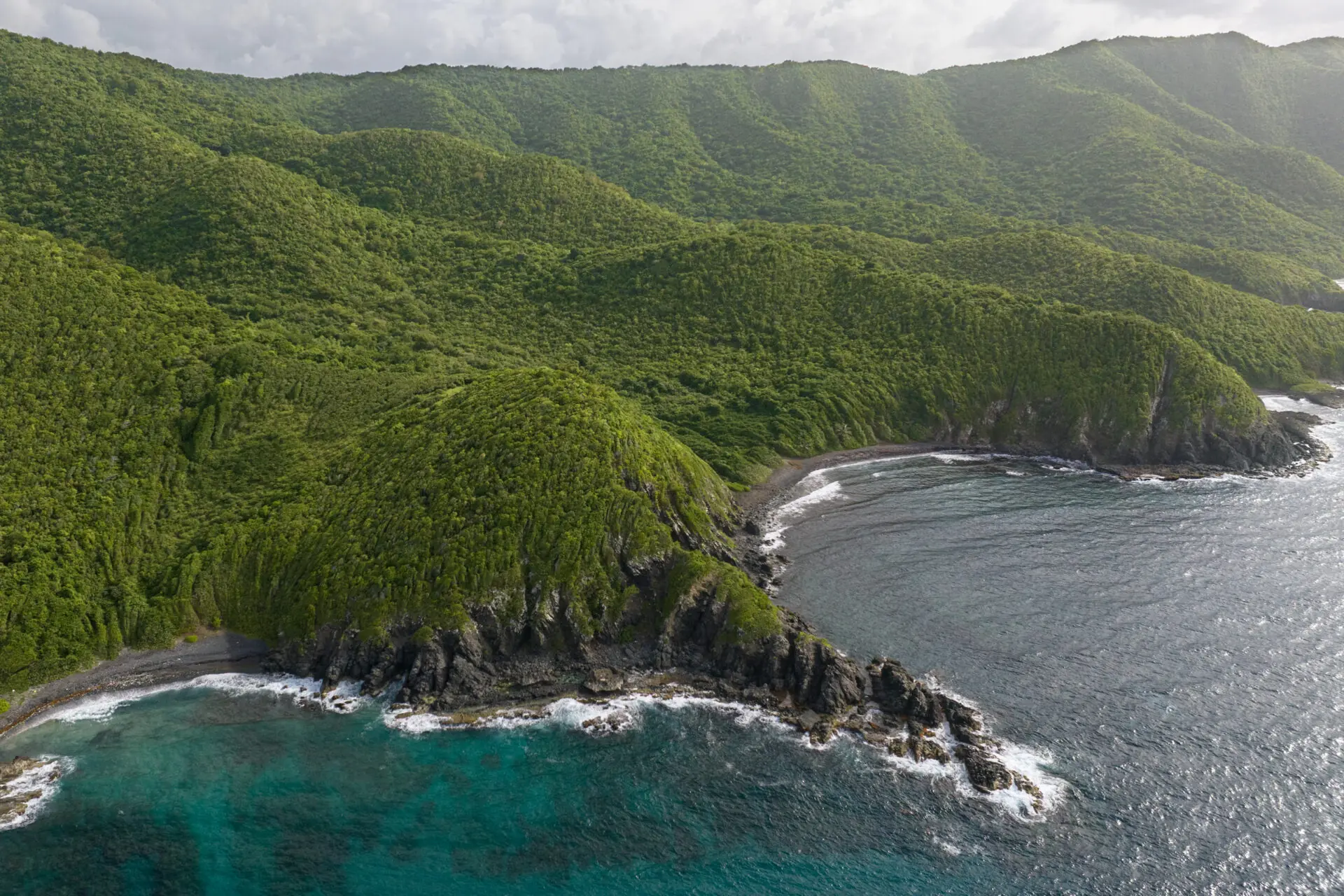
photo obtained from the oficial web page of the USVI Department of Planning & Natural Resources
The Maroon Ridge Trail is a landscape of great spiritual, cultural, and ecological significance on St. Croix. Located on the second highest point on St. Croix, the sustainably developed trail is nestled within a pristine, natural coastal forest with caves and cliffs that provide habitat for many native and endangered species.
Government of the U.S. Virgin Islands, Department of Planning and Natural Resources, managed by the Division of Territorial Parks and Protected Areas
Hiking Time: 1.5 - 2.5 hours
Intermediate to challenging
Wear closed-toe hiking shoes, bring a reusable water bottle/plenty of water, use sun protection: hat, sunscreen, sunglasses, long-sleeved shirt and pants; and bring insect repellent.
There are no restrooms or official stations on the trail. There is a parking area at the top of the trail, off Scenic Road W.
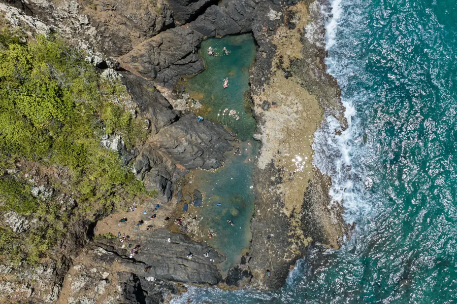
photo obtained from the oficial web page of the USVI Department of Planning & Natural Resources
The Maroon Ridge Trail, part of Maroon Sanctuary Territorial Park, served as a refuge and source of freedom for numerous enslaved Africans in the Virgin Islands and the Western Hemisphere.
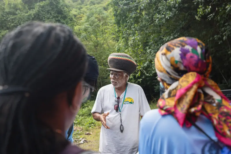
Olasee Davis in photo obtained from the oficial web page of the USVI Department of Planning & Natural Resources
Community leaders, non-profit organizations, and other stakeholders, including biologists and anthropologists, supported the protection of these historic and sacred lands.
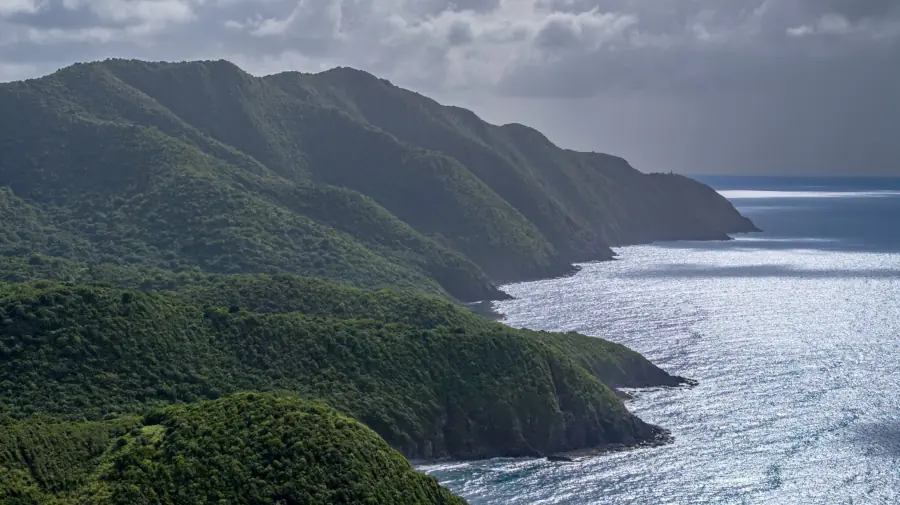
photo obtained from the oficial web page of the USVI Department of Planning & Natural Resources
This trail will be part of the largest territorial park in the U.S. Virgin Islands.
Soils
The predominant soil types along the Maroon Ridge Trail are Victory, Southgate, Cramer, Jealousy, Maho Bay, and Parasol.
Series: Victory
Order: Inceptisol
Taxonomic name: Loamy-skeletal, mixed, superactive, isohyperthermic Typic Haplustepts
General description: Victory soil forms on volcanic slopes and summits in the semi-arid climates of St. Croix and St. John. It is moderately deep, well-drained, and has a very stony loam texture, ideal for natural pastures and livestock grazing.
Interesting Notes:
- The Victory series was officially established in 1965.
- It is the representative soil series of the Virgin Islands!
Series: Southgate
Order: Inceptisol
Taxonomic name: Loamy-skeletal, mixed, active, isohyperthermic Lithic Haplustepts
General description: Southgate soil is found on the summits and slopes of volcanic hills. It is a shallow, well-drained soil of moderate permeability, composed of material weathered from igneous rock. Its profile extends to a depth of only about 17 inches.
Interesting Notes:
- This soil is characterized by a high amount of rock fragments (gravel and stones), giving it a skeletal texture.
- Although it is shallow and stony, this soil allows for the growth of shrubs and native vegetation.
Series: Cramer
Order: Mollisol
Taxonomic name: Clayey, mixed, active, isohyperthermic, shallow Typic Haplustolls
General description: Cramer soils are shallow and moderately permeable. They formed from eroded material of extrusive igneous parent rock and are found on the slopes and mountains of the Virgin Islands.
Interesting Notes:
- This series was established in 1965.
- Most areas are used for pastureland, and a few are used for small-scale tropical fruit production.
Series: Jealousy
Order: Mollisol
Taxonomic name: Fine, smectitic, isohyperthermic Typic Haplustolls
General description: Jealousy soils are moderately deep and permeable. They formed from plutonic rock residue and are found on the summits and slopes of volcanic hills and mountains.
Interesting Notes:
- This series was established in 1995.
- Many areas are being transformed into urban zones.
Series: Maho Bay
Order: Mollisol
Taxonomic name: Loamy, mixed, superactive, isohyperthermic, shallow Typic Haplustolls
General description: The Maho Bay soil is found on the steep slopes of St. John and is composed of weathered volcanic rock residue. It is shallow, well-drained, and has a fertile topsoil layer that supports hardy grasses such as guinea grass (Megathyrsus maximus) and buffelgrass (Cenchrus ciliaris).
Interesting Notes:
- Its surface horizon is very dark (with a value of 10YR 2/2, on the Munsell chart), rich in organic matter and classified as a mollic epipedon, typical of fertile soils.
- Although it develops in tropical zones, its profile varies from slightly acidic to very strongly acidic, depending on the horizon and exposure to weathered volcanic materials.
Series: Parasol
Order: Mollisol
Taxonomic name: Fine, vermiculitic, isohyperthermic Typic Haplustalfs
General description: Parasol soils are formed from plutonic residual material. They are very deep and moderately permeable, and are found on the slopes and foothills of volcanic hills and mountains.
Interesting Notes:
- Slopes range from 2 to 12 percent.
- Many areas have been urbanized.
This Web Soil Survey map contains scientific information detailing the taxonomy (classification) of soils. The taxonomic classification of soils is summarized in abbreviations. By selecting these abbreviations, you will be able to access the soil series corresponding to that area. The soil profile is provided with its respective horizons (layers) for each soil. This information is provided by the National Cooperative Soil Survey compiled by NRCS (Natural Resources Conservation Service). It is considered one of the largest and most comprehensive databases in the United States.