Reef
Bay
Trail
St. John, US Virgin Islands
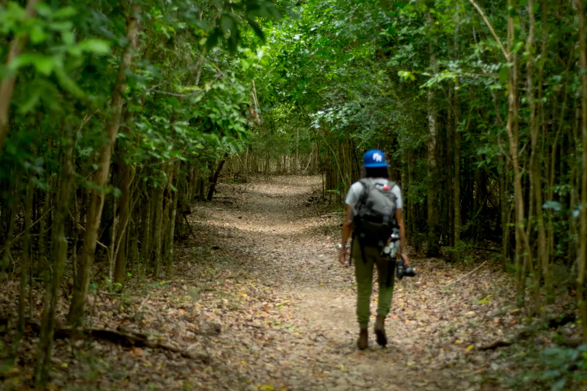
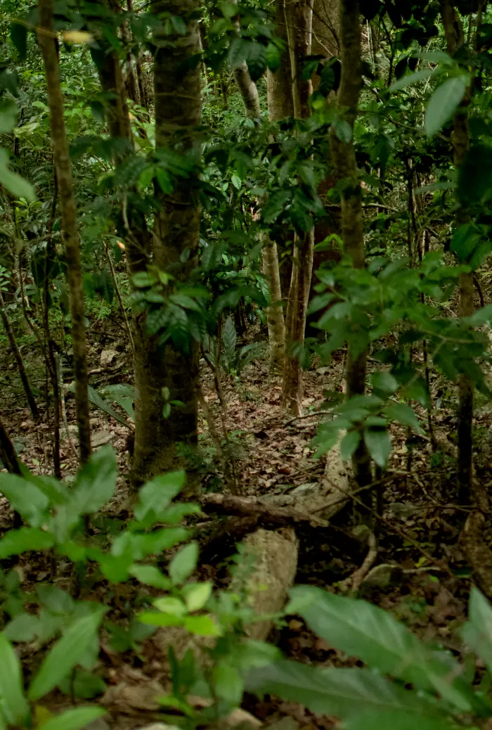
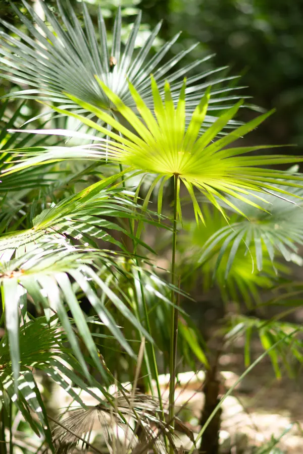
The Reef Bay Trail is one of the most fascinating hikes in Virgin Islands National Park on St. John. Extending just over four miles round trip, the trail winds through dense forests, past colonial ruins, and by petroglyphs carved by the Taíno people more than a thousand years ago. From its monumental trees to a hidden waterfall, the trail offers a journey through the ecological and cultural history of the Caribbean.
Management: National Park Service
Hiking Time: 2-4 hours approx. depending on the route
Intermediate to difficult
Access the trail via Centerline Rd. Wear appropriate footwear, bring plenty of water, use sun protection, visit during the hours of least sun.
(340) 776-6201 - Virgin Islands National Park Visitor Center
Parking at the top of the trail. There are no restrooms or official ranger stations on the trail.
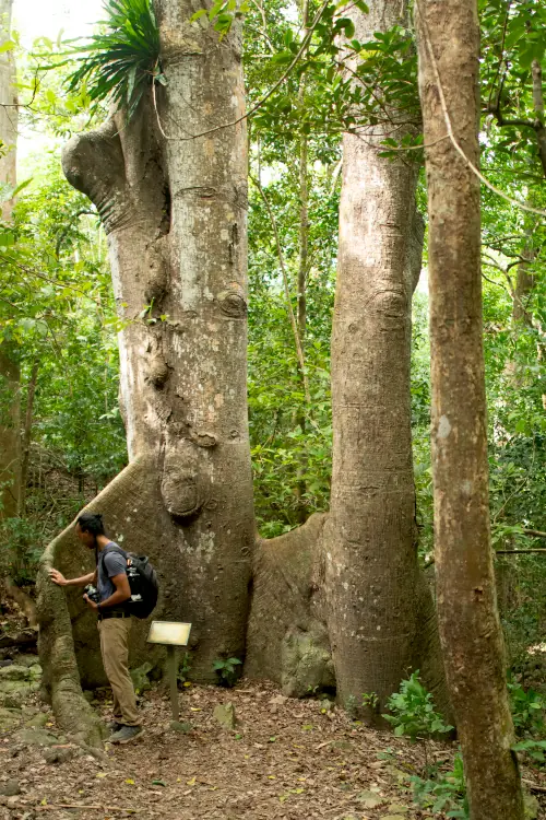
The trail leads to some of the oldest trees on the island, including native species that have survived for centuries in this semi-arid tropical ecosystem.
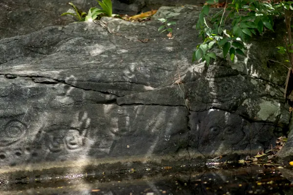
A short detour from the main trail leads to ancient petroglyphs, carved over a thousand years ago by the Taíno people. Situated just above a natural pool, these carvings become more vivid when lightly splashed with water.
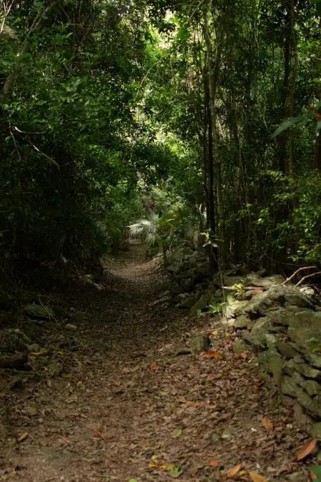
The trail was once used by donkeys to transport sugarcane and other products from the sugar mill to ships on the coast.
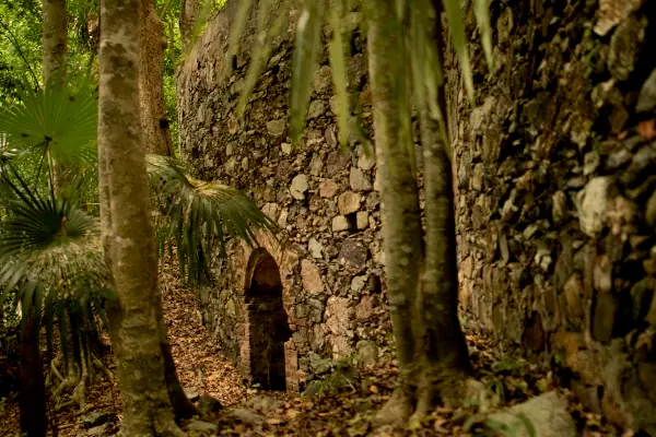
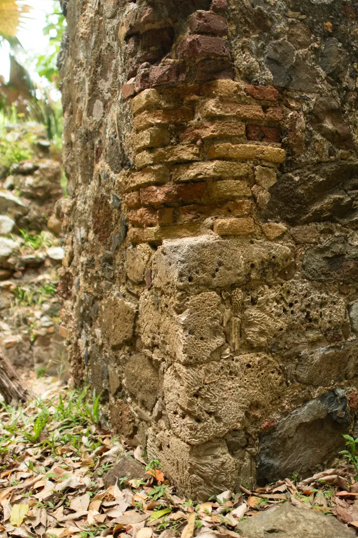
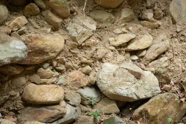
Along the trail, you will encounter the ruins of the Jossie Gut Sugar Estate, a sobering testament to the colonial history of both the island and the wider Caribbean.
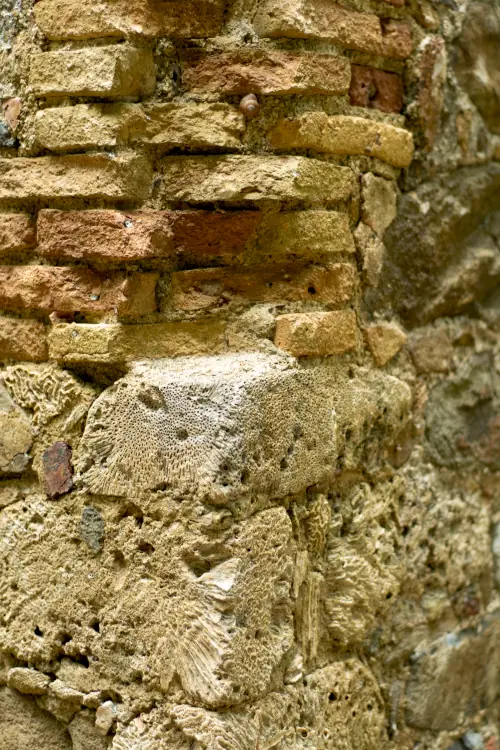
Within the sugar mill’s remains, you can see coral used as building blocks—a direct reflection of the forced labor endured by enslaved people. Because St. John lacked natural stone quarries, enslaved workers were forced to harvest and transport this coral from the sea to construct these massive structures.

During the hike, you may spot many species, both endemic and introduced. One of these is the white-tailed deer (Odocoileus virginianus), a species introduced in the late 18th century for recreational hunting. Today, recreational hunting is prohibited on the islands, resulting in a larger population.

Soils
Along the Reef Bay trail, the soils series that predominate are Annaberg, Maho Bay, Victory, and Southgate; soils shallow to moderately deep soils formed from weathered residue of volcanic rock.
Series: Annaberg
Order: Molisol
Taxonomic name: Loamy-skeletal, mixed, superactive, isohyperthermic Lithic Haplustolls
General description: The Annaberg series consists of shallow, well-drained, moderately permeable soils found on the summits and slopes of volcanic hills and mountains. They formed from weathered material of extrusive volcanic rock.
Interesting Notes:
- They contain between 10% and over 60% rock fragments (gravel and pebbles), giving them a loose and well-aerated texture, ideal for species adapted to rocky terrain.
- They are small soils, currently used mainly as pastureland or rangeland, with native vegetation of hardy shrubs and grasses, and in some areas, for residential or commercial development.
Series: Victory
Order: Inceptisol
Taxonomic name: Loamy-skeletal, mixed, superactive, isohyperthermic Typic Haplustepts
General description: Victory soil forms on volcanic slopes and summits in the semi-arid climates of St. Croix and St. John. It is moderately deep, well-drained, and has a very stony loam texture, ideal for natural pastures and livestock grazing.
Interesting Notes:
- The Victory series was officially established in 1965.
- It is the representative soil series of the Virgin Islands!
Series: Maho Bay
Order: Molisol
Taxonomic name: Loamy, mixed, superactive, isohyperthermic, shallow Typic Haplustolls
General description: The Maho Bay soil is found on the steep slopes of St. John and is composed of weathered volcanic rock residue. It is shallow, well-drained, and has a fertile topsoil layer that supports hardy grasses such as guinea grass (Megathyrsus maximus) and buffelgrass (Cenchrus ciliaris).
Interesting Notes:
- Its surface horizon is very dark (with a value of 10YR 2/2, on the Munsell chart), rich in organic matter and classified as a mollic epipedon, typical of fertile soils.
- Although it develops in tropical zones, its profile varies from slightly acidic to very strongly acidic, depending on the horizon and exposure to weathered volcanic materials.
Series: Southgate
Order: Inceptisol
Taxonomic name: Loamy-skeletal, mixed, active, isohyperthermic Lithic Haplustepts
General description: Southgate soil is found on the summits and slopes of volcanic hills. It is a shallow, well-drained soil of moderate permeability, composed of material weathered from igneous rock. Its profile extends to a depth of only about 17 inches.
Interesting Notes:
- This soil is characterized by a high amount of rock fragments (gravel and stones), giving it a skeletal texture.
- Although it is shallow and stony, this soil allows for the growth of shrubs and native vegetation.
This Web Soil Survey map contains scientific information detailing the taxonomy (classification) of soils. The taxonomic classification of soils is summarized in abbreviations. By selecting these abbreviations, you will be able to access the soil series corresponding to that area. The soil profile is provided with its respective horizons (layers) for each soil. This information is provided by the National Cooperative Soil Survey compiled by NRCS (Natural Resources Conservation Service). It is considered one of the largest and most comprehensive databases in the United States.